Daniel Gumb’s Maps
Cartography, or map making, in the 18th century was usually carried out by professional surveyors or land agents. However we have physical evidence of five maps created by Daniel, who was able to apply his accuracy of measurement and his knowledge of mathematics and geometry to create them.
I was aware of only four maps in existence, until this map of “Trevagera”, created in 1743 and the earliest so far of Daniel Gumb’s maps, was discovered in September 2025.
Find out what else was happening in Daniel’s life when he created these maps.
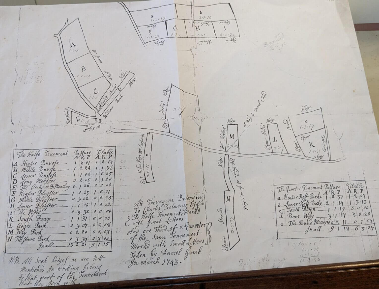
Trevagera Estate Map from 1743
“All Trevagera Belonging To Charles Trelawny Esquire. (The Halfe Tennement, mark’d with Great Letters. And one Third, of a Quarter of the same Tennement mark’d with Small Letters)
Taken by Daniel Gumb in March 1743″
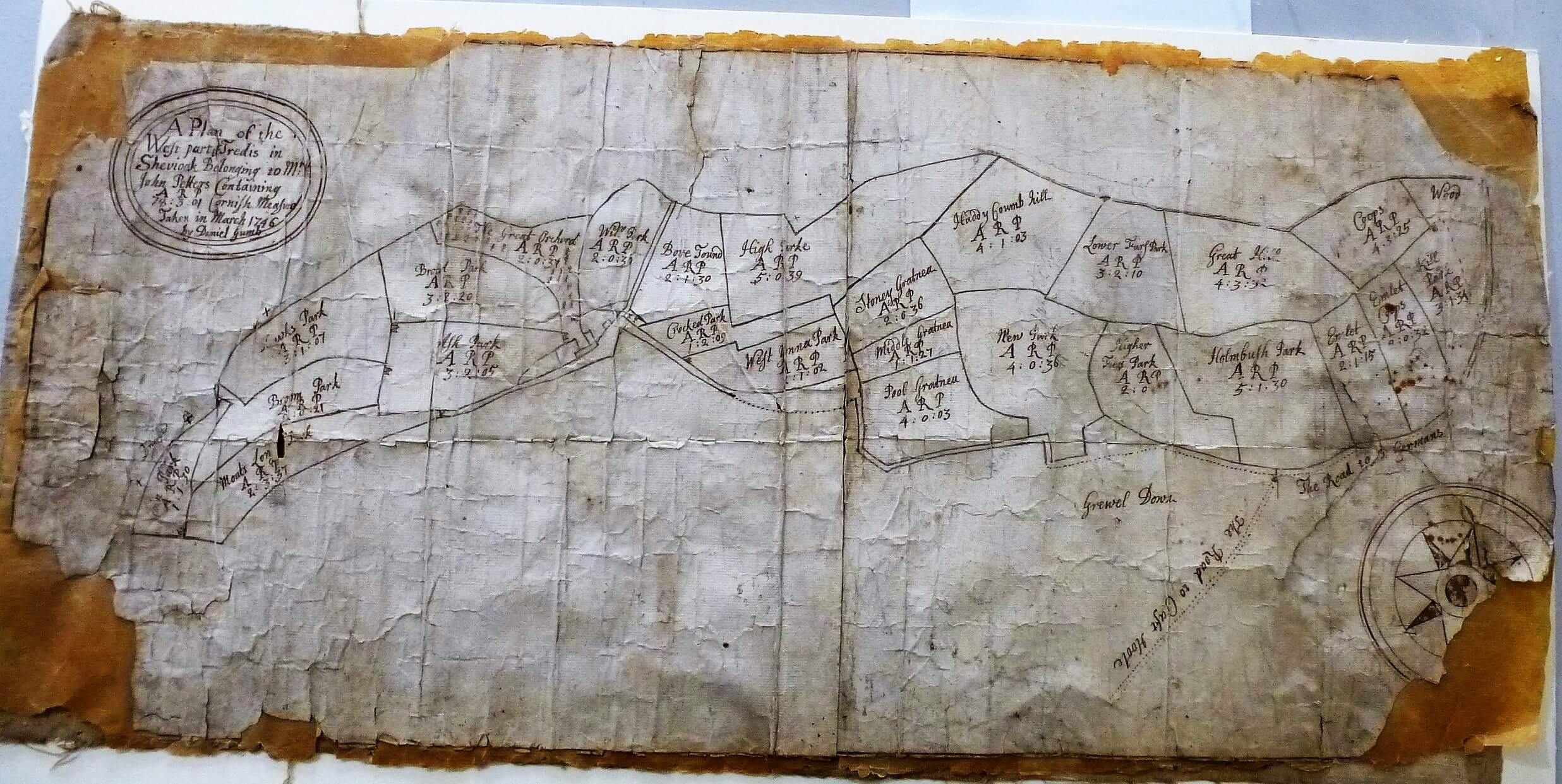
Tredis Estate Map from 1746
“A Plan of the West part of Tredis in Sheviock. Belonging to Mr John Petters. Containing ARP 78:3:01 Cornish Measure
Taken in March 1746 by Daniel Gumb”
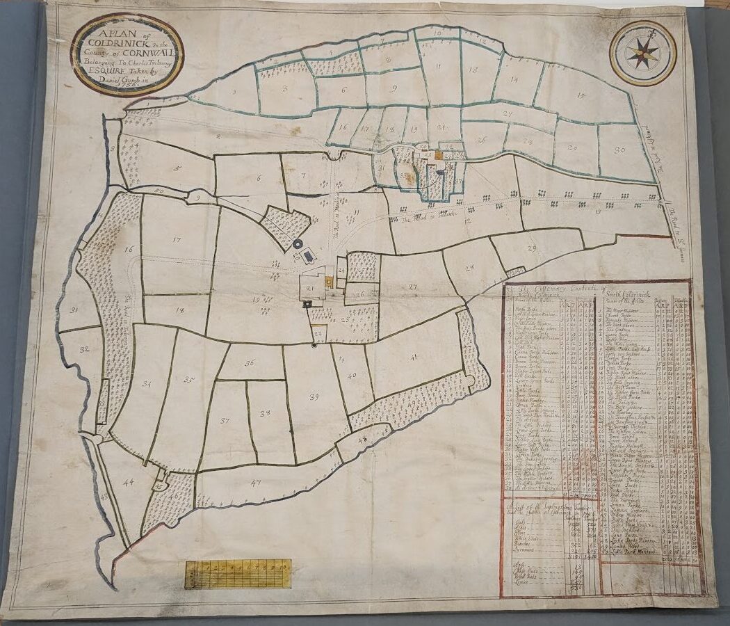
Coldrenick Estate Map from 1756
“A PLAN of COLDRINICK in the County of CORNWALL. Belonging To Charles Trelawny ESQUIRE. Taken by Daniel Gumb in 1756”
Credit: Published under licence from the Buckinghamshire Archives. Subject to Copyright, no reproduction allowed.
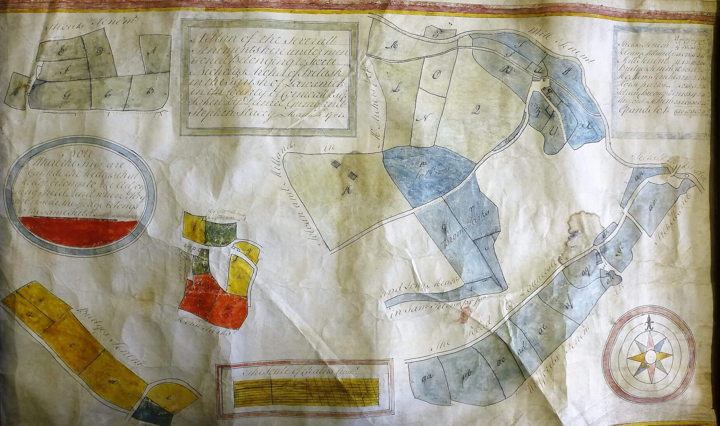
Trelaske Estate Map from 1761
“A plan of the severall tenements here under mentioned belonging to Swete Nicholas Archer of Trelask in the Parish of Lawanick in the County of Cornwall Esq. Taken by Daniel Gumb and Stephen Stacey March 1761.”
It’s also thought that Daniel supplied and installed a sundial for Trelaske House in 1760.
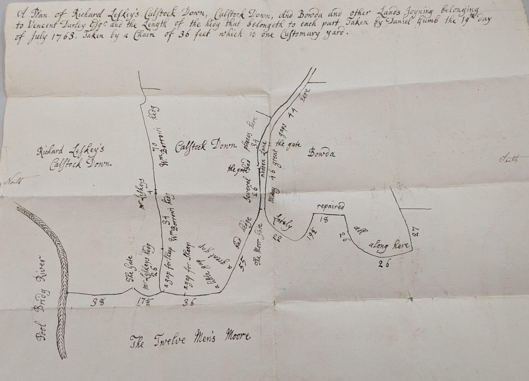
The Twelve Men’s Moore map from 1763
“A Plan of Richard Leskey’s Calstock Down, Calstock Down, And Bowda and other lands joyning belonging to Vincent Darley Esq. and the length of the hedg that belongeth to each part. Taken by Daniel Gumb the 19th day of July 1763. Taken by a chain of 36 feet which is one customary yard.”
This area was called Twelve Men’s Moor because of the twelve men that were granted rights by Launceston Priory to graze animals on the moor. Richard Luskey had been keeping significantly more animals on the moor than his allocation allowed, therefore overgrazing it to the detriment of his neighbouring farmers. In 1758, after some years of local dispute, the land owner Vincent Darley referred the matter to Parliament to resolve.
Perhaps Daniel was asked to create this map to help Darley better manage the grazing ?